Bathymetric and Shoreline Study at Sims Beach, Euclid, Ohio
Delivering precise lakebed and shoreline data to support coastal planning and design efforts.
CVE’s Survey Department recently completed a comprehensive bathymetric and natural shoreline study along a section of Lake Erie adjacent to Sims Beach in Euclid, Ohio. This effort combined on-water surveying with detailed shoreline investigations to develop an accurate understanding of lakebed elevations and littoral boundaries within the study area.
Field operations were conducted using a manned survey vessel equipped with high-precision GPS technology and a single-beam echo sounder to collect detailed depth data across the lakebed. Cross-section elevations were recorded at 25-foot intervals, extending from near the shoreline to approximately 1,000 feet offshore. To ensure data accuracy and reliability, the survey team performed periodic rod checks using a GPS unit mounted on a 25-foot rod, allowing for direct lakebed readings and confirmation that all measurements met engineering and design standards.
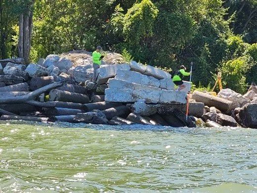
In areas where vessel access was limited, the survey team conducted a wading survey to capture nearshore elevations. A robotic Total Station was set up on shore while a crew member carefully waded into the water to collect direct shots of the lakebed, proceeding only as far as conditions allowed. Together, these complementary survey methods ensured a complete and highly accurate dataset for both bathymetric and shoreline conditions.
Beyond field data collection, the survey team also conducted extensive research to identify the natural shoreline within the project limits. This included reviewing parcel data, historic aerial imagery, city and county records, and applicable regulatory criteria to develop a preliminary assessment of probable littoral rights. Draft documentation was submitted for review, and final materials were coordinated with the Ohio Department of Natural Resources (ODNR) to support regulatory approval and future planning efforts, including submerged land lease considerations.
The completed study provides a reliable, comprehensive dataset to support ongoing coastal planning and improvement initiatives along the Lake Erie shoreline.